By Lisa Hawk
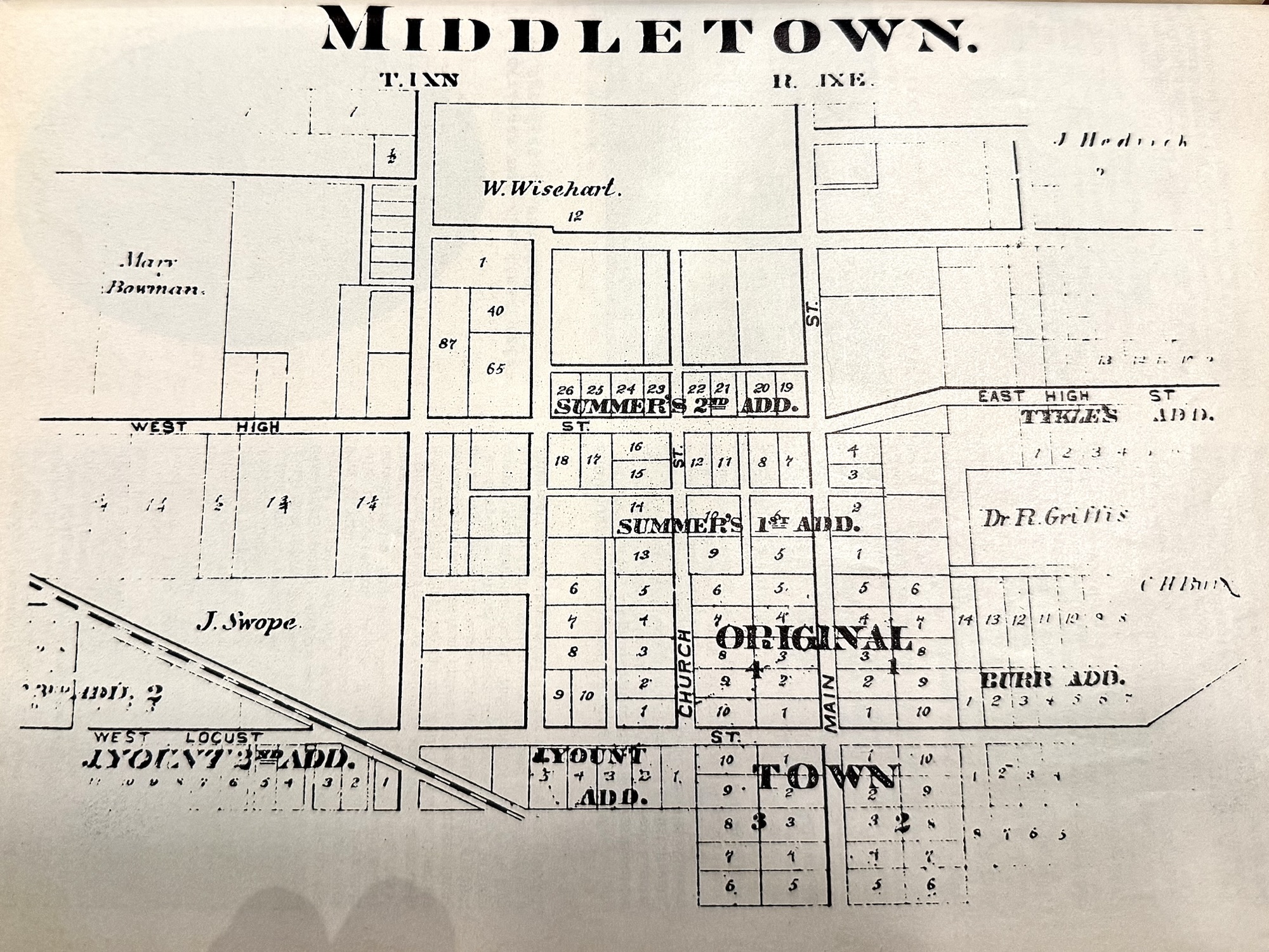
Middletown was originally platted as a town on October 9, 1829. The original plat map was recorded by Thomas Ginn, who was Henry County Recorder. Jacob Koontz was the person who delivered the map to the recorders office in New Castle.
Take a close look at the original map. You will notice that the north and south streets are not named as they are today. In 1829, what we know as 5th Street was named Main Street. And what we know as 6th Street, was called Church Street. You will notice that SR 236 had not yet been created.
If you look at the streets that ran east to west, you will notice that they were named as they are today.
Most of the lots on the map were 66’ wide and 165’ deep, totaling 1/4 acre.
The Original City Building (white painted building) is sitting on Block 1, Lot 1.
If you would like to find more buildings that are still standing …. Check these…
Block 3 part of Lot 1 is the current empty Farmers State Bank. Block 4 part of Lot 1 is where Moore’s Drugs used to be, this building is currently apartments by the Stark Family. And, Block 4 part of Lot 10 is the current Papa Pepperoni building.
What do you remember from the past building in our town that have now changed?
References
Memories, Dreams and Reflections of Middletown, 1975.
Beacon.com , Beacon property records for Henry County.
Original Plat Map of Middletown, located at Middletown Fall Creak Township Historical Society.

Leave a Reply